Destructed cities of Ukraine
Detecting building damage with satellite data
A war has been raging for two years in Ukraine by now. The World Bank and Ukrainian authorities assume that there have been at least 500,000 completely destroyed and 1.5 million partially destroyed apartments and residential buildings. Using satellite data, we tried to map the extent of the destruction in three Ukrainian cities under Russian control: Mariupol, Sievierodonetsk, and Bakhmut.
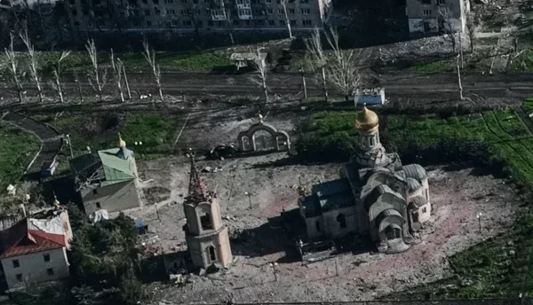
In Sievierodonetsk, before the war, about 100,000 people lived here; now, according to the residents, there are very few, with estimates assuming 10,000. According to experimental analysis, 36 percent of the buildings are destroyed, including important infrastructure such as a power plant or significant places such as the famous Ice Palace.
In Mariupol, Russian propaganda claims to be reconstructing the city. However, as satellite analysis shows, the city is still full of ruined buildings. In Bakhmut, almost all social, cultural, and sporting facilities were destroyed or damaged: kindergartens, schools, stadiums, youth and children’s centers.
To determine the damaged buildings, analysts from Vertical 52 evaluated radar satellite data from before and after the fighting, identifying changes on the earth’s surface. To recognize building damage, the data was automatically compared with building outlines.
The model was validated for destruction in Gaza. Tests for the Ukraine results showed an accuracy of around 80 percent. The analysis is experimental with regard to Ukraine.
The investigation is a collaboration between satellite journalists from Vertical52 and the Russian exile media outlet IStories Media. The data were visualized by the Tagesspiegel Innovation Lab.